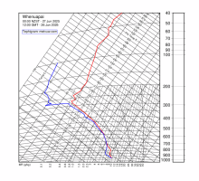
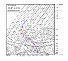
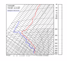
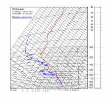
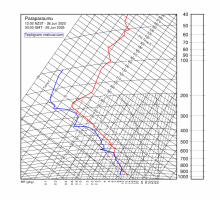
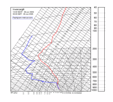
| Whenuapai | Paraparaumu | Invercargill |
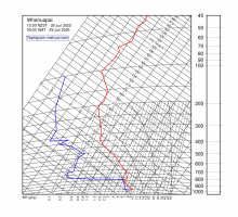 | 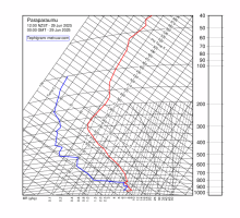 | 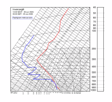 |
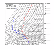
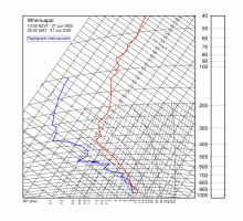
| 1200 NZST Sun 29 Jun 2025 | 1200 NZST Sun 29 Jun 2025 | 1200 NZST Sun 29 Jun 2025 |
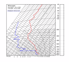 |  |  | | 0000 NZST Sun 29 Jun 2025 | 0000 NZST Sun 29 Jun 2025 | 0000 NZST Sun 29 Jun 2025 |
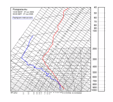
 |  |  | | 1200 NZST Sat 28 Jun 2025 | 1200 NZST Sat 28 Jun 2025 | 1200 NZST Sat 28 Jun 2025 |
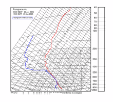
 | 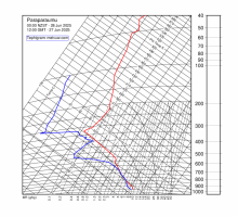 |  | | 0000 NZST Sat 28 Jun 2025 | 0000 NZST Sat 28 Jun 2025 | 0000 NZST Sat 28 Jun 2025 |
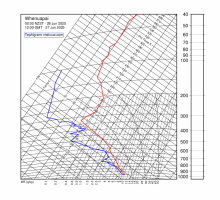
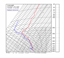
 |  | 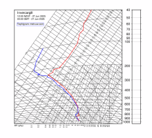 | | 1200 NZST Fri 27 Jun 2025 | 1200 NZST Fri 27 Jun 2025 | 1200 NZST Fri 27 Jun 2025 |
 |  |  | | 0000 NZST Fri 27 Jun 2025 | 0000 NZST Fri 27 Jun 2025 | 0000 NZST Fri 27 Jun 2025 |
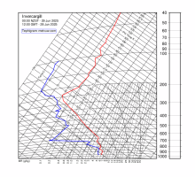
 |  |  | | 1200 NZST Thu 26 Jun 2025 | 1200 NZST Thu 26 Jun 2025 | 1200 NZST Thu 26 Jun 2025 |

